Show the map
Le Cros - Rouviac - Monteillat
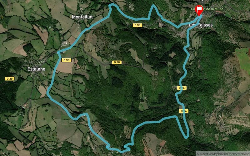


11.2 km
390 m
390 m
 Saint-Beauzély (12)
 Saint-Beauzély (12)
 Points of Interest table
| Accum. | Intermediary | |||||||
|---|---|---|---|---|---|---|---|---|
| POI | Description | Alt. | Dist. | D+ | D- | Dist. | D+ | D- |
 Event off organized on 05/01/2019
Trace n°85817
Ascent threshold : 3 m Distance threshold : 30 m Smoothing : No Origin of altitudes : MNT Aster GDEM
Ascent threshold : 3 m Distance threshold : 30 m Smoothing : No Origin of altitudes : MNT Aster GDEM
Loop
Dominant terrain : Path
Max alti. : 880 m
Avg alti. : 727 m
Min alti. : 582 m
Longest ascent : 320 m
Longest descent : 260 m
Dominant terrain : Path
Max alti. : 880 m
Avg alti. : 727 m
Min alti. : 582 m
Longest ascent : 320 m
Longest descent : 260 m
Elevation profile
More tools
Create a new roadbook page
Map and track on your website
Warning ! When you insert a Trace de Trail map on your website, you agree not to hide any element of the module (links to Trail Trail or Trail Connect banner)
Add a realisation
Validate
Add a realisation to share your chrono and describe the conditions that you encountered during you trail running !
Add a comment
Validate
LauraPicheral
30/07/21, 12:11:24
Chemins non entretenus. Les ronces m'ont finalement fait renoncer et descendre par la route...
30/07/21, 12:11:24
Chemins non entretenus. Les ronces m'ont finalement fait renoncer et descendre par la route...
Show the infos
Add a track