Show the map
avoriaz
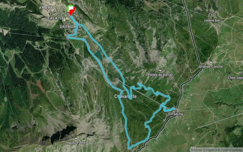


11.19 km
660 m
660 m
 Les Crosets (CH)
 Points of Interest table
| Accum. | Intermediary | |||||||
|---|---|---|---|---|---|---|---|---|
| POI | Description | Alt. | Dist. | D+ | D- | Dist. | D+ | D- |
Trace n°191072
Ascent threshold : 0 m Distance threshold : 0 m Smoothing : No Origin of altitudes : GPS
Ascent threshold : 0 m Distance threshold : 0 m Smoothing : No Origin of altitudes : GPS
Loop
Dominant terrain : Footpath
Max alti. : 2184 m
Avg alti. : 1940 m
Min alti. : 1746 m
Longest ascent : 450 m
Longest descent : 0 m
Route completed by the author : nc
Dominant terrain : Footpath
Max alti. : 2184 m
Avg alti. : 1940 m
Min alti. : 1746 m
Longest ascent : 450 m
Longest descent : 0 m
Route completed by the author : nc
Elevation profile
More tools
Create a new roadbook page
Map and track on your website
Warning ! When you insert a Trace de Trail map on your website, you agree not to hide any element of the module (links to Trail Trail or Trail Connect banner)
Add a realisation
Validate
Add a realisation to share your chrono and describe the conditions that you encountered during you trail running !
Add a comment
Validate
sylvainrunner
08/08/22, 17:13:16
Bonjour et merci pour le tracé. Je vais le parcourir la semaine prochaine (mi-août 2022).
08/08/22, 17:13:16
Bonjour et merci pour le tracé. Je vais le parcourir la semaine prochaine (mi-août 2022).
Show the infos
Add a track